Short Walks: Scotland
The English Lake District
1
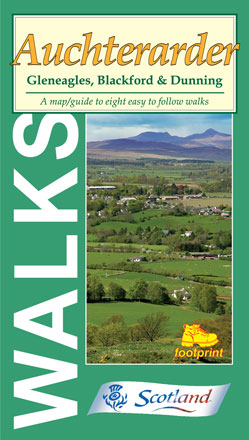
Auchterarder
Gleneagles, Blackford & Dunning
Price: £5.95
A map/guide to eight easy to follow walks
- The Oak Walk
- The Provost's Walk
- Johnny Matthew's Walk
- The Cadger's Walk
- Blackford to Auchterarder
- Craig Rossie
- Glen Sherup Forest
- Pitcairn Glen, Dunning
More info...
ISBN: 978-1-871149-75-3
Edition:2007
Scale:Various
Folded:119 x 210mm
Open:594 x 420mm
Weight:50gms
Hide info...
2
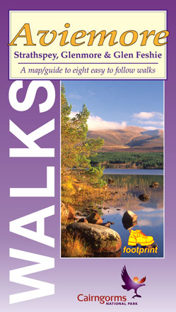
Aviemore
Strathspey, Glenmore & Glen Feshie
Price: £5.95
A map/guide to eight easy to follow walks
- Craigellachie Nature Reserve
- Aviemore - Boat of Garten
- Ryvoan Pass
- Loch Morlich from Glenmore
- Cairngorm Footbridge
- Loch an Eilein & Inverdruie
- Uath Lochan
- Glen Feshie
More info...
ISBN: 978-1-871149-73-9
Edition:2007
Scale:Various
Folded:119 x 210mm
Open:594 x 420mm
Weight:50gms
Hide info...
3
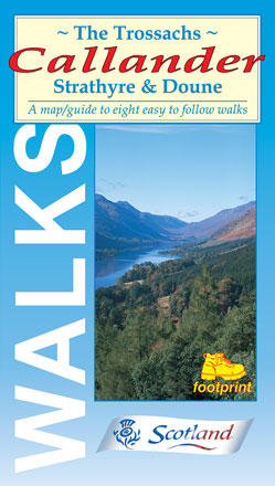
The Trossachs, Callander
Strathyre & Doune
Price: £5.95
A map/guide to eight easy to follow walks
- Callander Crags & Bracklinn Falls
- Callander to Strathyre
- Bracklinn Falls
- Glen Ample
- Strathyre - forest walk
- Balquhidder - Creag an Tuirc
- Doune - Castle & Ponds
- Loch Venachar
More info...
ISBN: 978-1-871149-20-3
Edition:2011
Scale:Various
Folded:119 x 210mm
Open:594 x 420mm
Weight:50gms
Hide info...
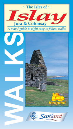
4
The Isles of Islay
Jura & Colonsay
Price: £5.95
A map/guide to eight easy to follow walks
- Finlaggan, Islay
- Ardnave Point, Islay
- Portnahaven, Islay
- Kintra, Islay
- Port Charlotte, Islay
- An Dùnan, Jura
- Kells Township, Jura
- Kiloran Bay, Colonsay
More info...
ISBN: 978-1-871149-38-8
Edition:2015
Scale:Various
Folded:119 x 210mm
Open:594 x 420mm
Weight:50gms
Hide info...
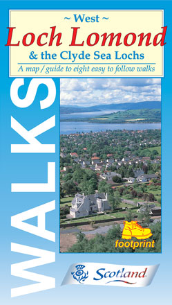
5
West Loch Lomond
& the Clyde Sea Lochs
Price: £5.95
A map/guide to eight easy to follow walks
- Balloch Castle Country Park
- Stoneymollan Trail
- Helensburgh Upland Way
- Rosneath Point
- Firkin Point, Loch Lomond
- Cruach Tairbeirt Walks
- Ardgartan Riverside Walk
- Inverarnan to Loch Lomond
More info...
ISBN: 978-1-871149-15-9
Edition:2010
Scale:Various
Folded:119 x 210mm
Open:594 x 420mm
Weight:50gms
Hide info...
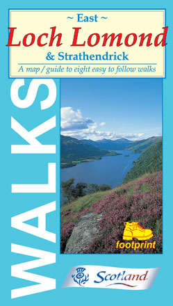
6
East Loch Lomond
& Strathendrick
Price: £5.95
A map/guide to eight easy to follow walks
- Gartocharn to Shore Wood
- Drymen & Buchanan Castle
- Conin Hill from Balmaha
- Balmaha Forest Walks
- Inchcailloch from Balmaha
- Craigie Fort to Milarrochy
- Sallochy to Rowardennan
- Rowardennan to Inversnaid
More info...
ISBN: 978-1-871149-16-6
Edition:2006
Scale:Various
Folded:119 x 210mm
Open:594 x 420mm
Weight:50gms
Hide info...
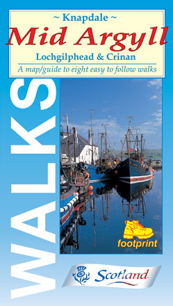
7
Knapdale, Mid Argyll
Lochgilphead & Crinan
Price: £5.95
A map/guide to eight easy to follow walks
- Kilmory Woodland Park
- Ardcastle Wood
- Mòine Mhòr - 'The Great Moss'
- Ardrishaig - The 39 Steps
- Crinan Canal towpath
- Arichonan Township
- Crinan Forest Walk
- Kilmartin Glen
More info...
ISBN: 978-1-871149-31-9
Edition:2009
Scale:Various
Folded:119 x 210mm
Open:594 x 420mm
Weight:50gms
Hide info...
8
Orkney
Heritage Walks
Price: £5.95
Created in association with Orkney Tourist Board, each sheet comprise individual maps for 8 simple and easy to follow walks on the Orkney Islands.
- Warbeth to Stromness
- Swartland Drove Road
- Binscarth Woods
- Hoxa Head
- Westness Heritage Walk
- Tuquoy
- Eday Heritage Walk
- Odin Bay
More info...
ISBN: 978-1-871149-55-5
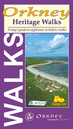
Edition:2003
Scale:Various
Folded:119 x 210mm
Open:594 x 420mm
Weight:50gms
Hide info...
Short Walks:
The English Lake District
Ambleside
Grasmere, Langdale & Elterwater
Price: £5.95
A map-guide to 14 walks around Ambleside, in the English Lake District
- Grasmere, Chapel Stile & Elterwater
- Grasmere & Helm Crag
- Grasmere & Easedale Tarn
- Grasmere & Alcock Tarn
- Rydal & Grasmere from Whitemoss
- Great Langdale & Baysbrown Wood
- Skelwith Bridge to Elterwater & Little Langdale
- The Langdale Pikes
- Ambleside, Troutbeck & Wansfell Pike
- Ambleside & Lily Tarn
- Ambleside & Jenkin Crag
- Ambleside & Loughrigg Tarn
- Red Screes
- Fairfield Horsehoe
More info...
ISBN: 978-1-871149-58-6
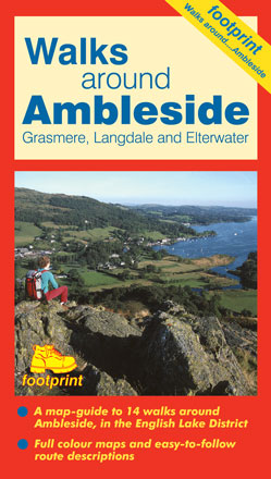
Edition:2002
Scale:Various
Folded:119 x 210mm
Open:594 x 420mm
Weight:52gms
Hide info...
Coniston
Hawkshead, Grizedale & Far Sawrey
Price: £5.95
A map-guide to 16 walks around Coniston, in the English Lake District
- Guards Wood
- Coniston Coppermines
- Coniston Old Man, Swirl How & Wetherlam
- Goats Water & Dow Crag
- Coniston to Carron Crag
- Holme Fell
- Coniston to Torver
- Natty Bridge
- Beacon Tarn
- High Dam
- Grizedale Forest
- Hawkshead Moor
- Claife Heights
- Latterbarrow from Hawkshead
- Tarn Hows
- Tilberthwaite & Little Langdale
More info...
ISBN: 978-1-871149-59-3
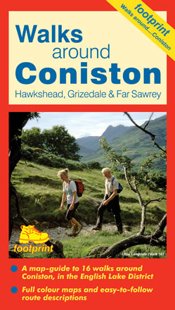
Edition:2014
Scale:Various
Folded:119 x 210mm
Open:594 x 420mm
Weight:52gms
Hide info...
Keswick
Borrowdale, Thirlmere & Threlkeld
Price: £5.95
A map-guide to 16 walks around Keswick, in the English Lake District
- Keswick, Friar's Crag & Castle Head
- Keswick to Latrigg Fell
- Keswick, Walla Crag & Ashness Bridge
- Castlerigg Stone Circle
- The Bowder Stone, Troutdale & Grange
- Rosthwaite & Castle Crag
- Rosthwaite & Dock Tarn via Watendlath
- Cat Bells & Brandelhow
- Harrop Tarn from Thirlmere
- Around Thirlmere from The Swirls
- Sprinkling Tarn & Styhead Tarn
- Threlkeld to Glenderaterra
- Portinscale & Swinside
- Newlands Valley from Hawse End
- Skiddaw from Latrigg Car Park
- High Seat & Bleaberry Fell
More info...
ISBN: 978-1-871149-57-9
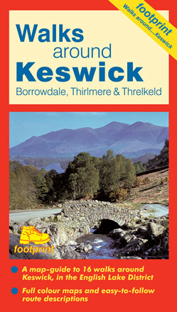
Edition:2004
Scale:Various
Folded:119 x 210mm
Open:594 x 420mm
Weight:52gms
Hide info...
Ullswater
Haweswater, Penrith & Swindale
Price: £5.95
A map-guide to 15 walks around Ullswater, in the English Lake District
- Hartsop to Angle Tarn
- Around Brothers Water
- Glenridding to Lanty's Tarn
- Glencoyne & Sheffield Pike
- Aira Force & Gowbarrow Fell
- Hallin Fell from Howtown
- Pooley Bridge to Glenridding
- Askham, Heughscar Hill and Helton
- Askham and Lowther Park
- Haweswater from Burnbanks
- Mardale Head to Small Water & Harter Fell
- Swindale
- Wet Sleddale
- Rosgill to Shap Abbey
- King's Meaburn
More info...
ISBN: 978-1-871149-60-9
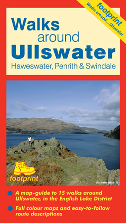
Edition:2016
Scale:Various
Folded:119 x 210mm
Open:594 x 420mm
Weight:52gms
Hide info...
Windermere & Kendal
Newby Bridge, Staveley & Grange-over-Sands
Price: £5.95
A map-guide to 16 walks in the Windermere & Kendal area of the English Lake District
- Windermere to Orrest Head
- The Lake Shore and Brant Fell
- Bowness to Hill Top via the ferry
- Bowness to Waterhead returning by the ferry
- Staveley to Potter Tarn
- Kentmere Reservoir
- Longsleddale to Green Quarter
- Scout Scar
- Kendal to Cunswick Scar
- Levens Park
- Whitbarrow Scar
- Grange-over-Sands to Hampsfell
- Cartmel
- Bigland Tarn & Backbarrow
- Chapel House Wood
- Gummer's How
More info...
ISBN: 978-1-871149-69-2
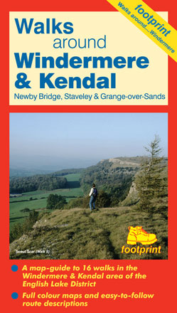
Edition:2014
Scale:Various
Folded:119 x 210mm
Open:594 x 420mm
Weight:52gms
Hide info...