Long Distance Paths

Coast to Coast Walk (West)
St Bees to Swaledale
Price: £9.95
One of two maps covering this 184 mile walk across northern England from St Bees on the west coast to Robin Hood's Bay on the east coast. This western sheet covers the route from St Bees to Swaledale.
Devised by A. Wainwright, the route now follows most of his original itinerary.
More info...
ISBN: 978-1-871149-63-0
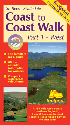
Edition:2015
Scale:1:50000
Folded:119 x 210mm
Open:594 x 420mm
Weight:52gms
Hide info...
Coast to Coast Walk (East)
Swaledale to Robin Hood's Bay
Price: £9.95
One of two maps covering this 184 mile walk across northern England from St Bees on the west coast to Robin Hood's Bay on the east coast. This eastern sheet covers the route from Swaledale to Robin Hood's Bay.
Devised by A. Wainwright, the route now follows most of his original itinerary.
More info...
ISBN: 978-1-871149-64-7
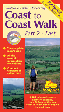
Edition:2017
Scale:1:50000
Folded:119 x 210mm
Open:594 x 420mm
Weight:52gms
Hide info...
The Dales Way
Ilkley to Bowness-on-Windermere
Price: £9.95
The Dales Way is a 79 mile (127km) long distance trail in the north of England, running between Ilkley, in North Yorkshire and Bowness-on-Windermere, in Cumbria. Much of the route passes through the Yorkshire Dales and Lake District National Parks. Starting out in Ilkley, the route runs along Wharfedale, passing the impressive ruins of Bolton Priory and the attractive market town of Grassington. It continues along the River Wharfe through dramatic limestone scenery before it crosses The Pennines to reach Dentdale and Sedbergh. It then skirts the Howgill Fells and crosses the M6 motorway to finish overlooking Lake Windermere.
This map-guide is laid out for walkers travelling from Ilkley to Bowness, although walkers travelling in the opposite direction should find it equally useful. Each panel includes a detailed route map, route profile and helpful notes on navigation.
There are link routes from Bradford, Leeds and Harrogate to the start of the route at Ilkley.
Download free link route map (12.8 MB)
More info...
ISBN: 978-1-9160029-3-7
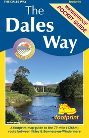
Edition:2019
Scale:1:40000
Folded:150 x 99mm
Open:594 x 420mm
Weight:0gms
Hide info...
The Fife Coastal Path
Kincardine Bridge to Newburgh
Price: £10.95
High quality, specially created strip map of this unique 116 mile coastal path from the Kincardine Bridge to Newburgh on the Firth of Tay.
For every copy of this map sold, a donation goes towards the practical management of the Fife Costal Path.
More info...
ISBN: 978-1-871149-99-9
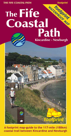
Edition:2019
Scale:1:40000
Folded:120 x 225mm
Open:450 x 840mm
Weight:64gms
Hide info...
The Fife Pilgrim Way
Culross/North Queensferry to St Andrews
Price: £10.95
A footprint map-guide to the 64 mile (104 km) route between Culross/North Queensferry and St Andrews
More info...
ISBN: 978-1-9160029-1-3
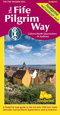
Edition:2019
Scale:1:40000
Folded:225 x 120mm
Open:720 x 450mm
Weight:0gms
Hide info...
The Speyside Way
Newtonmore - Buckie
Price: £10.95
The Speyside Way is one of 'Scotland's Great Trails'. It runs between Newtonmore, in the heart of Strathspey, 87 miles to Buckie, on the Moray Firth. The route passes through some of Scotland's most beautiful landscapes.
More info...
ISBN: 978-1-871149-97-5
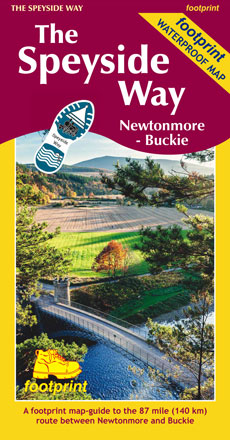
Edition:2019
Scale:1:40000
Folded:120 x 225mm
Open:720 x 450mm
Weight:40gms
Hide info...
The West Highland Way
Milngavie to Fort William.
Price: £10.95
The West Highland Way waterproof map from Footprint is a map-guide to the 95 mile (153km) route between Milngavie and Fort William.
For every copy of this map sold, a donation goes towards the practical management of the West Highland Way.
More info...
ISBN: 978-1-871149-93-7
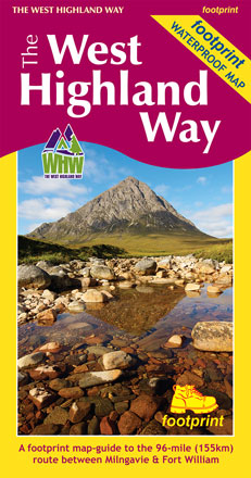
Edition:2017
Scale:1:40000
Folded:120 x 225mm
Open:840 x 450mm
Weight:60gms
Hide info...