Footprint Maps
Our range of footprint map-guides has been growing steadily since the first title was produced in 1988. These map-guides offer a unique combination of quality, legibility, ease of use and value for money.
Many are now published on waterproof paper, including our best selling map-guide of the West Highland Way, between Glasgow and Fort William, Scotland.
The following pages carry full details of these publications and how to buy them.
Long Distance Paths • Short Walks • Visitor Maps • Cycle Routes • Publication List
Best Sellers
The West Highland Way
Milngavie to Fort William.
Price: £10.95
The West Highland Way waterproof map from Footprint is a map-guide to the 95 mile (153km) route between Milngavie and Fort William.
For every copy of this map sold, a donation goes towards the practical management of the West Highland Way.
More info...
ISBN: 978-1-871149-93-7
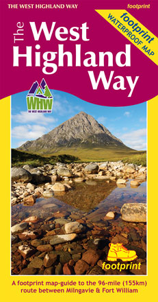
Edition:2017
Scale:1:40000
Folded:120 x 225mm
Open:840 x 450mm
Weight:60gms
Hide info...
The Fife Coastal Path
Kincardine Bridge to Newburgh
Price: £10.95
High quality, specially created strip map of this unique 116 mile coastal path from the Kincardine Bridge to Newburgh on the Firth of Tay.
For every copy of this map sold, a donation goes towards the practical management of the Fife Costal Path.
More info...
ISBN: 978-1-871149-99-9
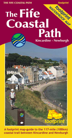
Edition:2019
Scale:1:40000
Folded:120 x 225mm
Open:450 x 840mm
Weight:64gms
Hide info...
The Fife Pilgrim Way
Culross/North Queensferry to St Andrews
Price: £10.95
A footprint map-guide to the 64 mile (104 km) route between Culross/North Queensferry and St Andrews
More info...
ISBN: 978-1-9160029-1-3
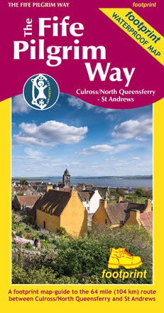
Edition:2019
Scale:1:40000
Folded:225 x 120mm
Open:720 x 450mm
Weight:0gms
Hide info...
Discover the Isle of Bute
Including West Island Way
Price: £9.95
This map is the perfect companion to take exploring the island, it's packed with information on how to get to Bute, what to see or do - and where to go, once you're there.
The map features Scotland's first long-distance footpath, the 30-mile West Island Way, alongside popular shorter walks.
As you'll discover, Bute's treasures include Mount Stuart, St Blane's Church, Rothesay Castle and Scotland's finest toilets!
Bute Conservation Trust receive a donation from each map sold.
More info...
ISBN: 978-1-871149-82-1
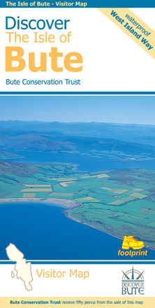
Edition:2017
Scale:1:30000
Folded:120 x 230mm
Open:840 x 594mm
Weight:78gms
Hide info...
Discover the Isle of Mull
Including the Isles of Iona, Ulva & Gometra
Price: £9.95
This map is the perfect companion to take exploring on the Isle of Mull; it's packed with information on how to get there; and what to see and do - and where to go, once you're there. The map features walking and cycling routes, wildlife and visitor attractions and where to eat, sleep and shop. As you'll discover, Mull's treasures include secluded beaches, wild mountains, magnificent eagles and historic castles.
More info...
ISBN: 978-1-871149-85-2
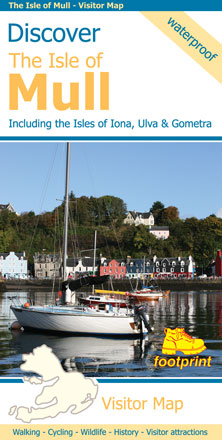
Edition:2014
Scale:1:65000
Folded:120 x 235mm
Open:850 x 670mm
Weight:75gms
Hide info...
Discover the Isle of Skye
An t-Eilean Sgitheanach
Price: £9.95
The largest of the Inner Hebrides, Skye is far more than it's justifiably famous mountain scenery. Traces of the past, from dinosaur footprints to ruined castles, are scattered amongst the rugged landscape. Wildlife abounds, otters fish along rocky shores whilst sea eagles patrol the skies above. Add to this a selection of cafes and restaurants serving some of Scotland's cuisine and you have a place guaranteed to make any visit memorable.
More info...
ISBN: 978-1-871149-90-6
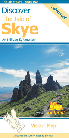
Edition:2017
Scale:1:110000
Folded:120 x 235mm
Open:960 x 670mm
Weight:65gms
Hide info...
Buying Footprint map-guides online:
All our map-guides can be purchased online from www.cordee.co.uk via the ' Buy' button at the bottom of each description panel.